案例媒体
案例说明
这个页面把案例媒体、完整 Prompt 和出处放在一起,方便你先看结果,再判断这条 Prompt 是否值得复制、收藏或加入对比。
案例解读
为了方便搜索、引用和后续复用,这里会把案例的适用场景、画面重点和 Prompt 结构拆成更容易浏览的说明。
这类案例适合用在什么场景
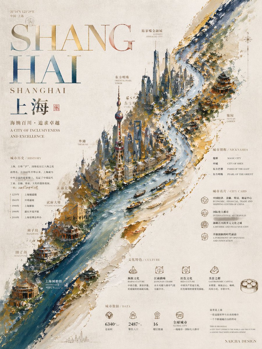
- 把它当作 UI 与社交媒体截图 的基准案例最合适,先看成片方向,再决定自己的 Prompt 要往哪边改。
- 如果你的目标也落在 插画、UI、截图 这些方向,这条案例特别适合先看图判断风格,再回头微调描述。
- 做 Prompt 对比时,也很适合作为控制组,只改一个变量去看结果变化。
画面重点与风格信号
- 这条案例最明显的风格信号集中在 插画、UI、截图,所以第一次改写时最好先保留这些关键词。
- 这类案例更值得先看界面密度、卡片层级,以及屏幕内容有没有先于文字讲清故事。
- 当前保留了 2 份媒体输出,适合顺手观察同一方向在多张结果里的稳定性。
Prompt 结构可以怎么理解
- 这条 Prompt 整体属于一条比较长、约束条件很多的 Prompt,很适合拿来判断这类方向到底需要写到多细。
- 关键词簇主要围绕 插画、UI、截图 展开,所以复用时可以先保留这组风格词,再替换主体、镜头、环境或文案信息。
- 最稳的改写方式通常是先保留结果方向和最强风格信号,只替换主体设定与场景块。
如果你是带着问题来的,可以先看这些角度
- 如果保留 插画、UI、截图,只换主体题材,结果最先变化的会是哪一部分?
- 这条结果里,哪些特征更像是 UI 与社交媒体截图 的结构特征,哪些又是标签风格本身带来的?
- 同分类的相关案例里,哪几条能给你更克制或更极致的相邻变体?
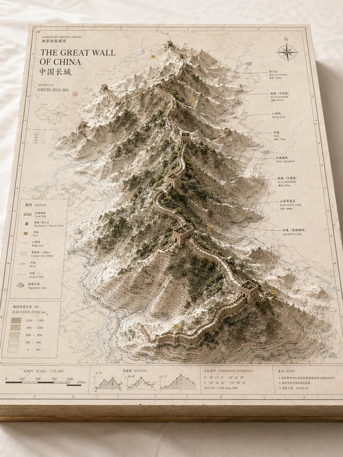
完整 Prompt
Please create a high-completion, high-texture, suitable-for-series-release "Landscape Archive Model" visual image based on the 【Theme】. This is not an ordinary map, nor an ordinary landscape illustration or city rendering, but a high-end archival visual image combining "2D map drawing + 3D regional model + professional explanation system + museum exhibition sense". The image needs to look like a real geographical research model, urban planning sandbox, architectural proposal model, or worldview setting exhibit, possessing a professional, restrained, precise, touchable high-end texture. 【Basic Settings】 Theme: 【Theme, for example Crater Lake / Guangzhou / Chongqing Mountain City / Island City / Ancient City Ruins / Post-Apocalyptic Ruins / Fantasy Continent / Game Main City】 Theme Type: 【Natural Landform / Urban Space / Mixed Landscape】 Core Subject: 【Core Subject, for example crater, canyon, mountain range, lake, CBD, old city district, landmark cluster, island city, ruins cluster, main city area】 Content Focus: 【Content Focus, for example terrain elevation difference / urban landmarks / road network structure / water system relationship / nature and city relationship / setting collection display】 Style Direction: 【Style Direction, for example geographic mapping style, paper carving model style, architectural proposal style, museum archive style, urban planning style, game setting collection style】 Main Color Tone: 【Main Color Tone, for example off-white, light gray, parchment white, sand color, snow white】 Auxiliary Color: 【Auxiliary Color, for example earth brown, rock gray, cold gray, light blue, moss green】 Accent Color: 【Accent Color, for example black thin lines, red routes, blue hydrological lines, yellow numbered markers】 Aspect Ratio: 【Aspect Ratio, for example 16:9 horizontal / 3:4 vertical / 4:5 vertical / 1:1 square】 【Image Structure】 The main body of the image is a rectangular map model board placed on a clean desktop or white cloth. The baseboard has real thickness, with cross-section structure visible at the edges, like an exquisite map slice or model base. The map surface is covered with clear but restrained information layers, including contour lines, road networks, hydrological lines, zoning boundaries, geographic textures, coordinate sense, slight annotations, and drawing borders. In the center or off-center area of the map, a three-dimensional main model "grows" three-dimensionally from the two-dimensional map, becoming the visual core of the entire image. If the 【Theme Type】 is Natural Landform: The subject can be composed of mountains, canyons, craters, lakes, basins, islands, glaciers, faults, coastlines, emphasizing terrain elevation differences, stacked contour line structures, rock wall textures, and natural landform undulations. If the 【Theme Type】 is Urban Space: The subject can be composed of core urban areas, CBDs, old city blocks, landmark building clusters, waterfront areas, road network nodes, bridges, water systems, park green spaces, emphasizing building volumes, city recognition, spatial layers, and planning structures. If the 【Theme Type】 is Mixed Landscape: It needs to simultaneously integrate natural terrain and artificially built environments, such as mountain cities, island cities, ancient city ruins, post-apocalyptic ruins, fantasy main cities, sci-fi bases, allowing natural landforms and urban structures to jointly form the core visual. 【Detail Requirements】 - The model surface retains the sense of map drawing and professional information - Terrain areas should have contour lines, slope layers, depression and undulation relationships - Building areas should have a sense of volume, block relationships, and clear layers - Water areas are represented using low-saturation light blue - Green spaces, forests, parks, and mountains can be represented using moss green or low-saturation green - Road networks, paths, transportation axes, or exploration routes can be represented with thin lines, but must not overshadow the main subject - If there are landmark buildings or key structures, they should have clear recognition - If there are fantasy, sci-fi, or game setting elements, the archive model and drawing display sense must be retained, rather than making them into pure scene illustrations 【Explanation System】 The edges of the map board need to be designed with complete and restrained explanation modules, including: - Outer frame line and inner frame line - Scale bar - Legend area - Title area - Archive number - Index markers - Annotation labels - Concise symbol explanations The text does not need to be fully readable, but the overall must present a real, clear, precise, orderly archival typographic structure. 【Composition and Camera】 Adopt an oblique overhead isometric or sandbox-style composition, with the camera observing the entire model board from about 30 to 45 degrees above, allowing the audience to simultaneously see the map plane, the three-dimensional main subject height, the edge thickness, and the explanation area. The visual center of gravity is concentrated on the central main model, and the reading path is: first look at the core subject, then look at the surrounding terrain/road network/water system/block information, and finally look at the legend, scale bar, and explanation area. 【Material and Lighting】 The overall needs to have a real model photography texture: - Paper texture - Map printing texture - Paper carving or sandbox model sense - Architectural model or terrain slice texture - Soft natural light - Delicate real shadows - Clean background - Low saturation, high-end, restrained Avoid cartoonization, cheap game UI sense, excessive clutter, excessive showing off, focusing on highlighting the unified visual of "map baseboard + three-dimensional main subject + professional explanation system". The final effect should look like a landscape archive model image that can be used for geography science popularization, urban research, architectural proposals, cultural tourism visual features, worldview setting collections, or high-end series covers.